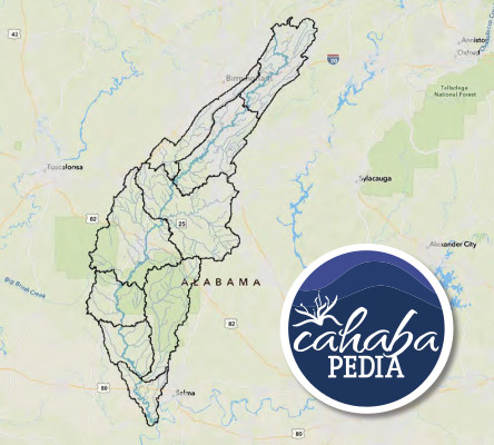
 Cahabapedia is an interactive and dynamic GIS map designed to provide an easily accessible way to reference data on the Cahaba River and its tributaries in one place.
From our beginning in 2009, Cahaba Riverkeeper has focused on the science of the river, its abundant and biodiverse flora and fauna, and the health of the people who live nearby and enjoy the water to swim, boat, and fish.
We collaborated with Savannah Riverkeeper and New Fields of Atlanta to create the platform for Cahabapedia and they helped us bring this dream to fruition. We appreciate the support of the Mosaic Foundation, Water Foundation, Colonial Pipeline Foundation, and other funders who recognized Cahabapedia’s significance for all citizens.
Explore Cahabapedia!
The tutorial button on the map is not yet functional. Please use this powerpoint for guided instructions and additional information on the map and project.